- Hiking
- Taiwan
- 100 Peaks
Zhi-Xue-Jian
Trip record of the Zhi-Xue-Jian traverse: Zhijiayang Mountain, Xue Mountain and Dajian Mountain.
Post content
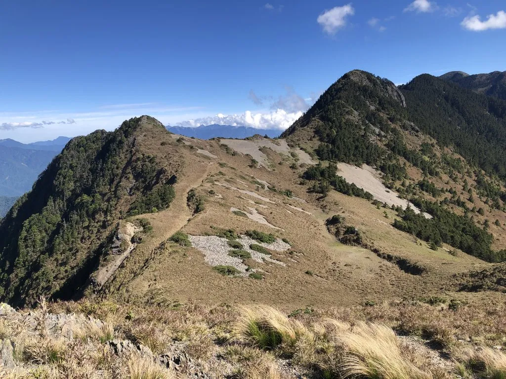
D0: Taipei ⇢ Huanqing Temple
Huanqing Temple
16:00This was my second time staying at Huanqing Temple, so it no longer felt so unfamiliar. There weren't many people today; I only met two gentlemen planning to day-hike Zhijiayang Mountain the next day. They were nice, and offered me a ride to Huanshan Village if I got up early the next morning. But I wanted to rest as much as time allowed, so I had to turn down their kind offer.
At dinnertime I walked to the convenience store at the intersection to forage for food. After sorting out dinner, I went back to Huanqing Temple early to rest. I slept on and off, and started to feel altitude sickness. I figured that if I still felt unwell by the time I reached Piaodan Cabin the next day, I would have to turn back. Fortunately, it began to ease in the small hours and never came back after that.
D1: Huanqing Temple ⇢ Old Xue Mountain Lodge Site
Huanqing Temple
04:00After breakfast, I set off from Huanqing Temple at four in the morning. It was still dark, and from my last visit I knew I would run into some dogs. Honestly, I was a bit scared. Sure enough, as soon as I entered Huanshan Village I heard barking. I also took a wrong turn and had to cut through the alleys between houses to get back on the route. One dog barked furiously on alert, while a black dog followed me the whole way, and for a while I worried it would follow me all the way up to Piaodan Cabin. When we reached Xima Farm, it joined the other dogs outside the farm, as if it had come to visit friends. I crossed the pitch-dark Sijielan River Suspension Bridge alone.
Trailhead
??:??The Sijielan River Suspension Bridge has been rebuilt, but it was still dark, so I couldn't tell what it looked like. Past the bridge is the spot for Shei-Pa National Park's remote check-in, where hikers report their entry by phone.
3.1K Campsite
05:25A short break. There were a lot more weeds here than I remembered, and red tape had been strung up on site, probably to keep people from camping here. Getting ready for the steep climb.
Sailiangjiu Campsite
08:25Caught up with the two day hikers just before the campsite.
Piaodan Cabin
10:08Just as the steep climb was about to end, my thighs were about to cramp too.
At the cabin I met a mountain porter who had come over from the Holy Ridgeline, followed by a team of four. I asked him about the water situation at tonight's campsite, and learned there was a small bucket of water available there.
Feeling a bit tired, I sat in the cabin and caught up on sleep. Later, the Holy Ridgeline team of five and two teams of two day-hiking Zhijiayang all gathered at the cabin.
Zhijiayang Mountain
12:00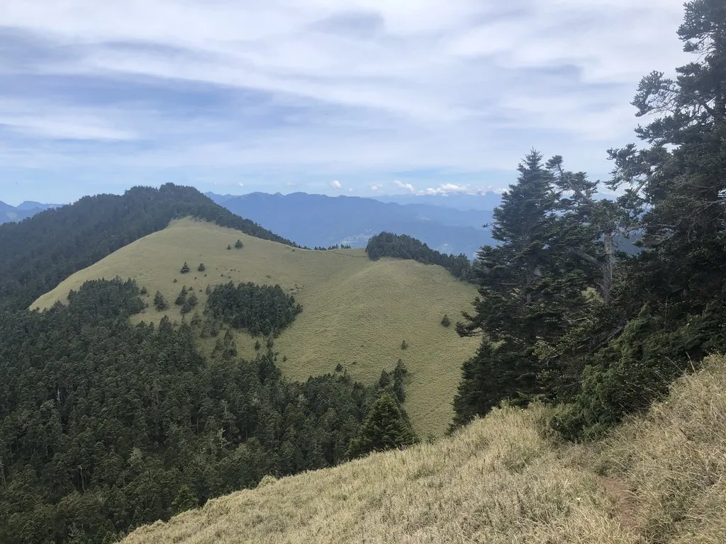
Old Xue Mountain Lodge Site
14:00After resting, I dropped down to fetch water. It hadn't rained for a while, so I had to descend deeper than the planned route before finding a small pool, fed only by a slow trickle of running water. After filtering all my water here, I went back to camp.
Back at camp, it was pitching the tent, zoning out, dinner and sleep.
Today was probably the first time I had climbed more than 2,000 meters in a single day.
D2: Old Xue Mountain Lodge Site ⇢ Perfect Valley
Old Xue Mountain Lodge Site
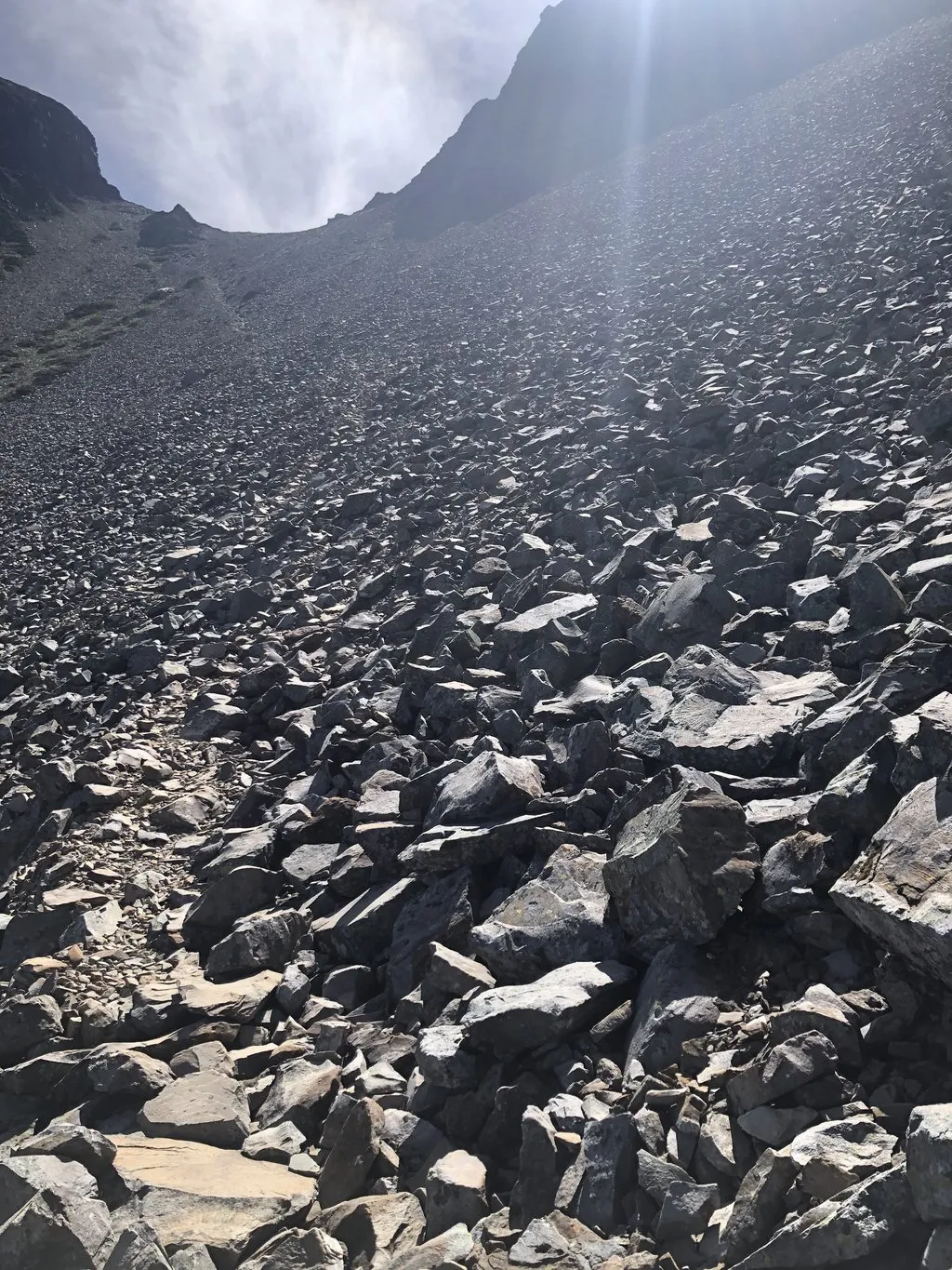
05:26First thing in the morning, I had to face the hardest section of Zhi-Xue-Jian. To prepare for it, I had watched other hikers' trip videos online at least three times. The first half mostly follows a scree-filled gully upward; the rocks here are bigger and more stable, with a few small obstacles to get past. The second half goes straight up a scree slope of smaller rocks that often slide under your feet, and most of the time I had to hold on to the sparse grass. Only after the traverse section did the trail become steadier. There had been a mountain accident near here not long before, so I walked with extra care.
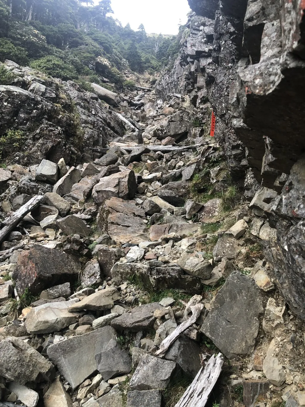
Xue Mountain Main Peak
07:56My first time on Xue Mountain Main Peak. Although it's Taiwan's second-highest peak, the area around the triangulation point is much flatter than on Yushan (Jade Mountain), the highest. Hikers kept arriving via the main Xue Mountain trail. After logging my summit, I set off toward Cuichi Cabin.
Cuichi Pond
09:32I filled up on plenty of water at Cuichi Pond, because I would camp tonight at Perfect Valley, which has no water, so I had to carry it over from Cuichi. Took a long break in the shade by the pond, hiding from the sun. The section toward Perfect Valley crossed several more rockfall slopes, and in some places I even had to descend without being able to see the trail ribbons ahead. Fortunately, I had watched the videos before setting out, so I was mentally prepared and felt much steadier.
Perfect Valley
15:46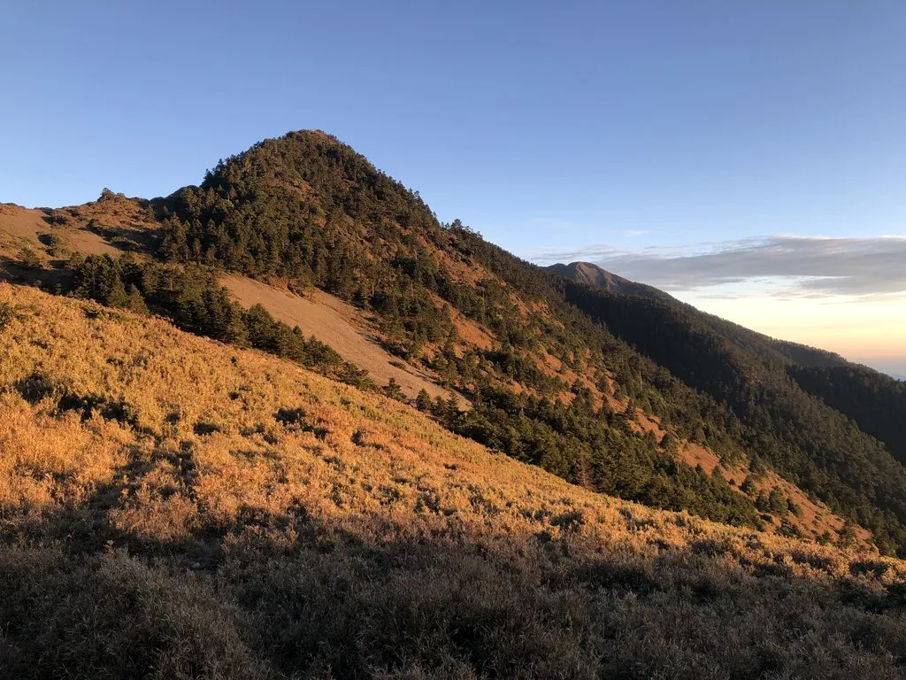
Besides me, two teams of two were expected to camp at Perfect Valley tonight. When I arrived, I met one of the teams; after walking around Perfect Valley, they decided to camp in the trees on the ridge. After looking around myself, I chose to camp down in the valley. The other team had reportedly gone on to Woodpecker Campsite. Woodpecker Campsite is better sheltered from the wind, but it was more than an hour's walk further and the campsite is small, so I didn't want to take that risk.
After putting down my pack, I wandered around to take in the scenery. Only then did I discover some terrible news: my camera settings were wrong, and every video I had shot before this was overexposed. After walking around the campsite, I started setting up camp. I wanted to pitch next to a clump of grass for shelter from the wind, but the ground there was sloped, so I couldn't get the tent pitched very straight.
The wind was fairly strong at night, shaking the tent and making it hard to fall asleep. In the small hours the wind died down, and I finally began to drift off.
D3: Perfect Valley ⇢ Firebreak Trailhead
Perfect Valley
05:30It was already light at half past five. After setting off, as expected, I met the other team of two at Woodpecker Campsite.
Xue Mountain Southwest Peak
06:58At one point I strayed off the route. After twenty or thirty meters, the trail grew less and less clear, so I quickly checked my offline map and went back to the correct route, where I found stone pillars that hikers had stacked up from rocks on the spot. These hikers have so much energy!
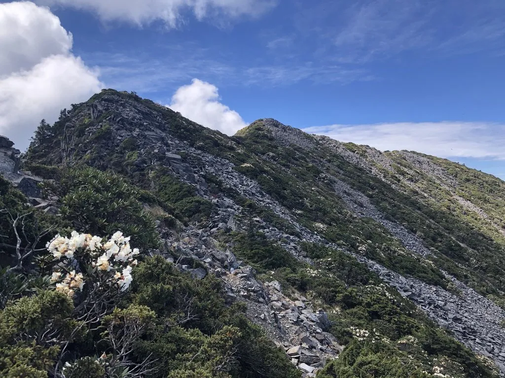
Dajian Mountain
09:55At the Dajian Mountain triangulation point, I looked back, saw the Woodpecker Campsite team on the opposite peak, and waved to them. The forecast said rain would start in the afternoon, so after a short break I headed for Youpolan Cabin. On the way to Youpolan Cabin, all the dwarf bamboo was in bloom, and the bamboo grassland as far as I could see had a faint purple tinge. Unfortunately, the weather outlook wasn't good, and all I wanted was to reach Youpolan Cabin as soon as possible so I wouldn't get soaked.
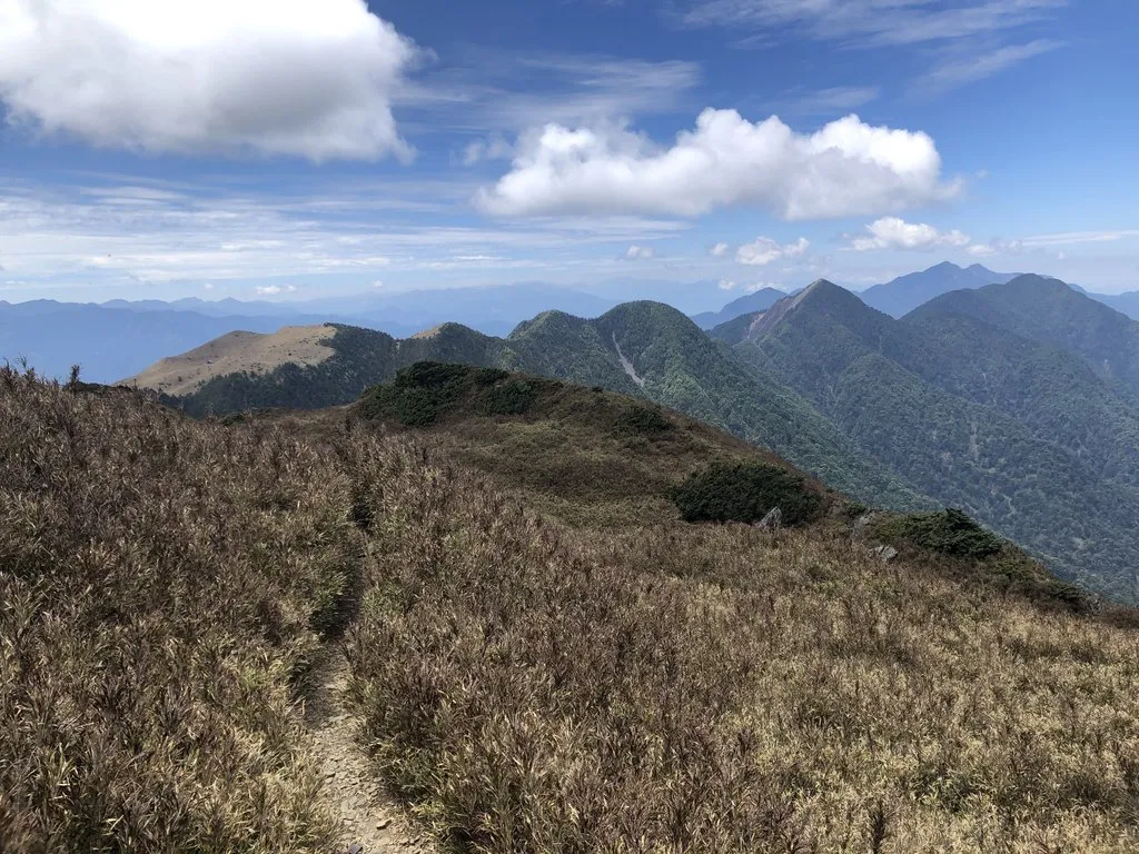
Youpolan Cabin
11:40By the time I reached Youpolan Cabin, the fog had already rolled in. I met a hiker taking a break; later he took supplies to help his teammate coming back from Xiaojian Mountain. After a while, two more teams of two arrived before the rain, and they all seemed to be handling it with ease. After refilling my water, I started to hesitate about whether to go straight down: heavy rain was expected to start the next afternoon, and if I went down the next day, I could only catch an afternoon bus back to town. But at the moment I didn't want to rush down in the rain either. I hesitated until two in the afternoon, and finally made up my mind to head for the trailhead.
Tuilun Mountain
16:11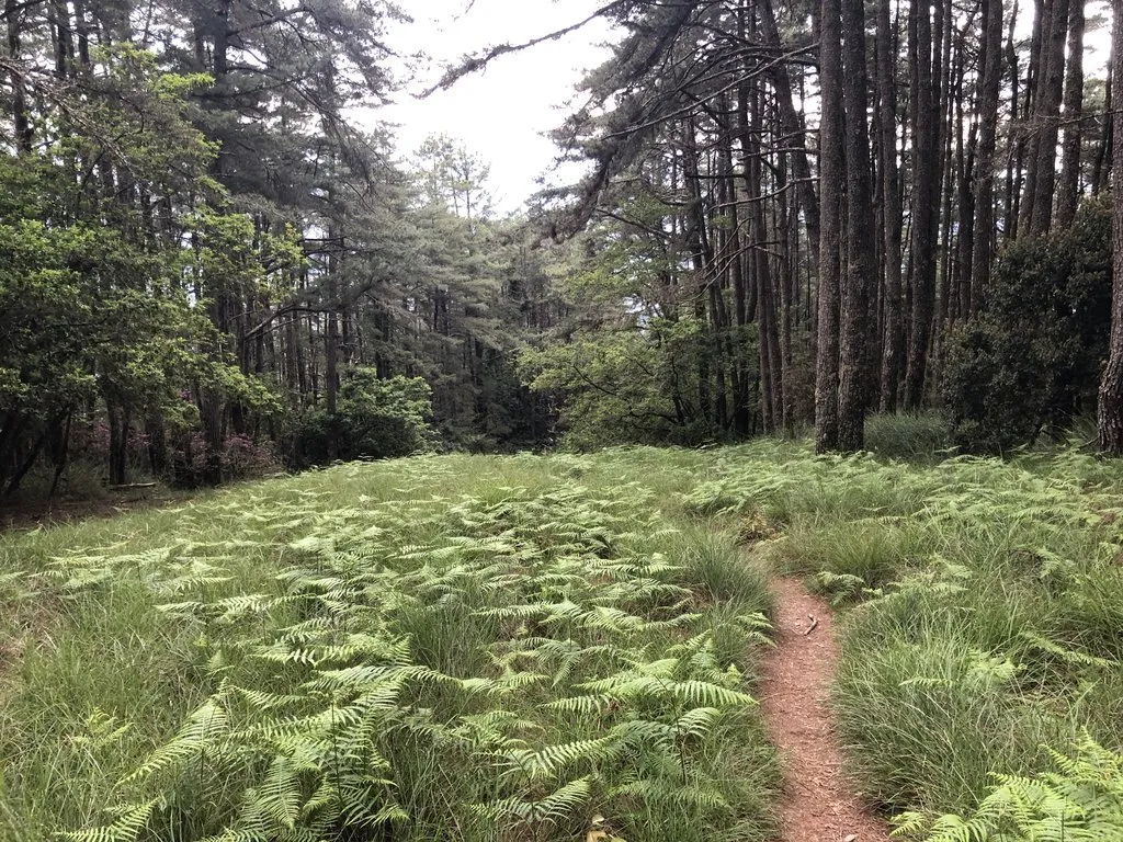
The downhill along the firebreak was very pleasant, but unfortunately it started raining before I reached the Hunters' Hut. I put on my rain jacket and pants and kept heading down.
Hunters' Hut
17:10The Hunters' Hut campsite looked flat and comfortable, but I wanted to make sure I could catch the early bus the next morning.
Firebreak Trailhead
19:07By the time I reached the trailhead, it was completely dark. I was a little worried about the hornets' nest at the trailhead, and for a moment thought about walking straight out. But I couldn't find the way out in the dark, and my phone also needed charging, so I went back to the trailhead and camped right there. After pitching the tent and laying out my sleeping pad, I ate some trail snacks and lay down without even bothering to unpack my down quilt. I thought the altitude was already low enough that I'd sleep fine, but maybe because it had just rained, I got colder and colder through the night. Still, I couldn't be bothered to unpack the down quilt.
In the middle of the night, a Reeves's muntjac was barking outside, sounding like it was only five meters away. The muntjac itself was no problem, but wasn't it afraid of calling a yellow-throated marten over too? I didn't want a midnight battle to defend my tent! Besides the muntjac, a hawk-cuckoo kept calling nonstop. Its rising song, phrase after phrase, was fun to listen to, but I wanted to sleep, Mr. Hawk-Cuckoo!
D4: Firebreak Trailhead ⇢ Zhongxing Road Junction
Firebreak Trailhead
04:50Leshan Bridge
05:15Renshou Bridge
06:30Zhongxing Road Junction
06:48In the end, I arrived at Zhongxing Road Junction two and a half hours early, and waited for the bus by the roadside, watching the chickens from the farmhouse across the road wander around while scrolling on my phone and zoning out.